Mussulo Island Masterplan

Master planning for Mussulo Island to guide sustainable development while protecting its natural environment.

Client

Urbinveste

Project date

2015

Mussulo is a peninsula located just south of Luanda, the capital of Angola. Development on this low-lying peninsula has been largely unplanned, lacking a formal structure. In 2015, Urbinveste appointed Zutari to provide transport, marine, and utility infrastructure master planning for the Mussulo Island project. The goal was to establish a development framework that supports growth while safeguarding the natural environment for both tourists and Angolans.

The opportunity

The development of Mussulo Island required a comprehensive assessment of existing infrastructure and environmental conditions. The peninsula’s complex location and low-lying terrain posed challenges, including vulnerability to coastal erosion, flooding, and climate change impacts. There was a clear need for a structured approach to guide sustainable development and inform the architect’s future strategies.

What we did

Zutari conducted a high-level review of the existing infrastructure, covering power, water, waste, drainage, communications, geotechnical conditions, flood risk, contamination, coastal and marine systems, and transport networks, including marine transport. Liaising with relevant government agencies, we established key principles to develop a shared understanding of critical transport and infrastructure issues.

Based on the collected information, we proposed options and network models that shaped the development direction. These were refined into clear infrastructure strategies, supported by engineering solutions and guiding principles for future development.

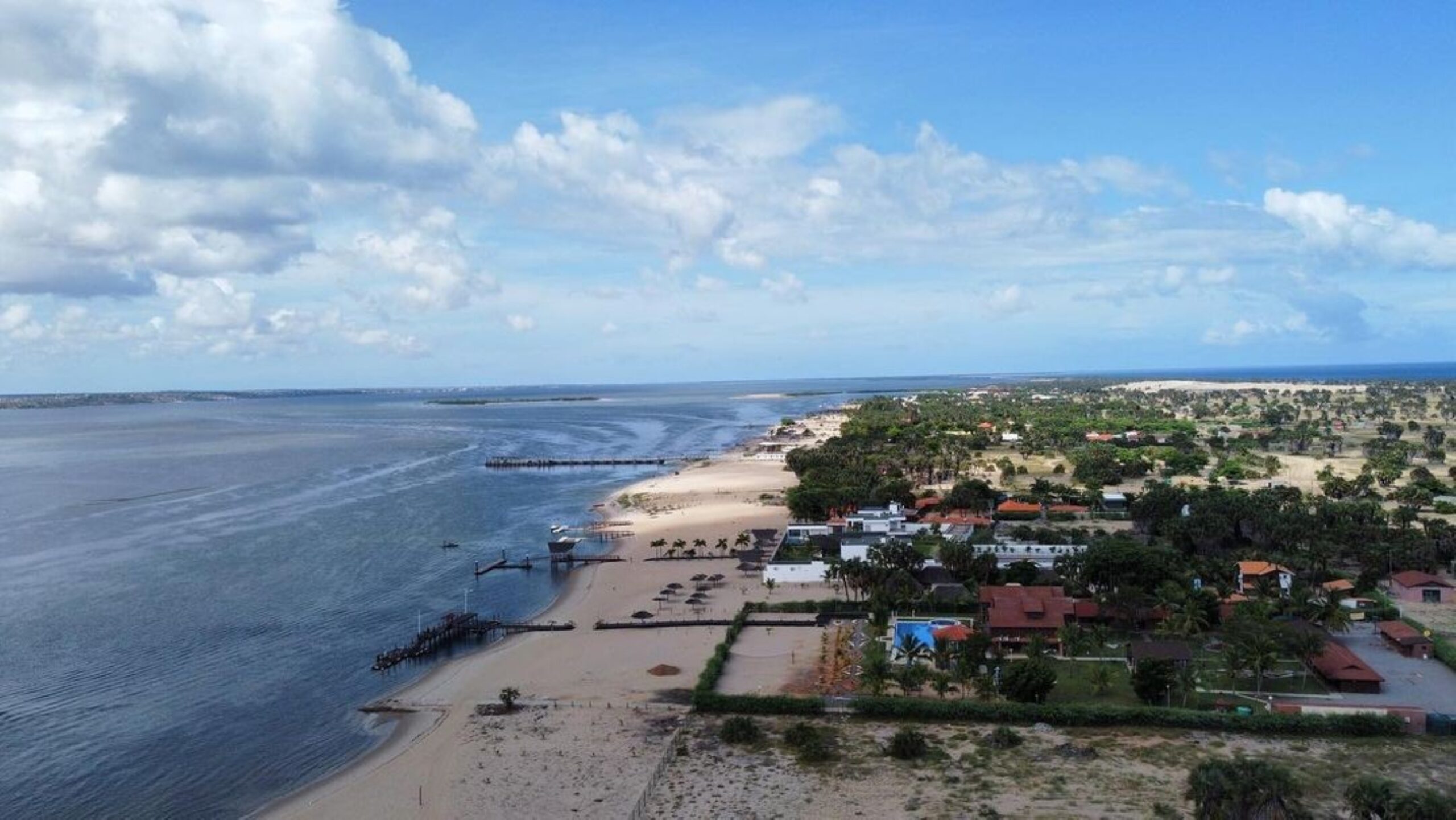
The port and coastal engineering scope included analysing current and future design conditions, accounting for long-term sea level rise based on Intergovernmental Panel on Climate Change recommendations. Wind and wave data were assessed using National Centers for Environmental Prediction data.

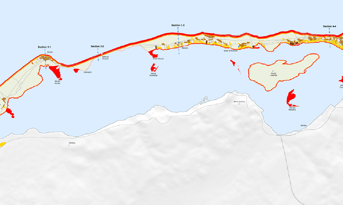
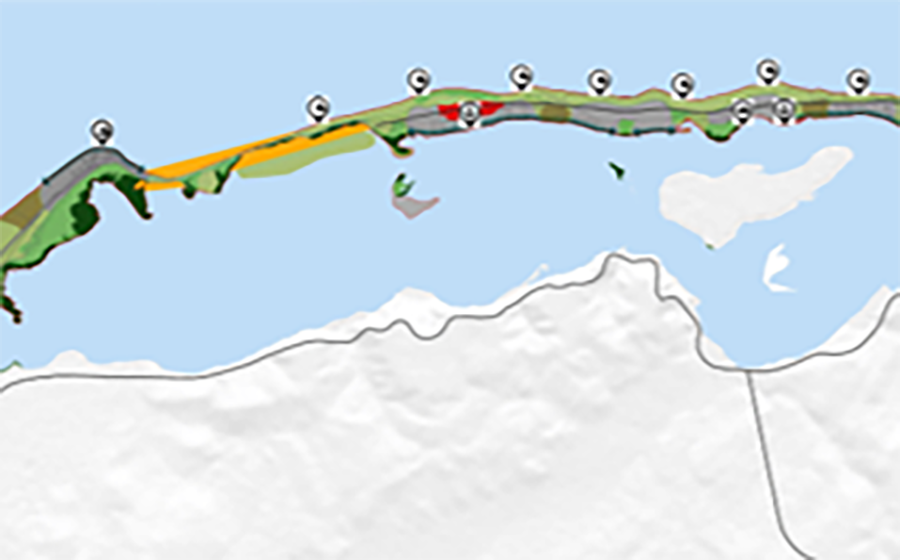
Zutari also undertook a high-level coastal vulnerability assessment, which was not part of the original scope. This included:

  • Reviewing topography, bathymetry, and morphological trends surrounding the peninsula

  • Preparing topographical maps highlighting low-lying areas at risk of inundation

  • Mapping the coastline into sandy, tidal flat, and mangrove zones, marking exposed settlements

  • Assessing hazards to establish setback buffers for sustainable development

  • Evaluating long-term coastal protection strategies and climate adaptation measures


A more detailed analysis followed, using SBeach to assess short-term storm erosion. Longer-term erosion and recession were evaluated with desktop analysis, considering extreme inundation and sea level rise scenarios. This led to a coastal vulnerability zoning map and preferred adaptation strategies for each zone.
The master plan balances infrastructure development with environmental protection, ensuring the sustainable future of Mussulo Island.

The outcome

The Mussulo Masterplan provides a framework aligned with international best practices for integrated island-wide infrastructure and transport strategies. It guides sustainable development, supports climate resilience, and preserves the natural environment for future generations.

By combining infrastructure expertise with environmental assessment, the Mussulo Masterplan ensures that future development is both sustainable and resilient, setting a benchmark for responsible island development.

This masterplanning project aimed to create a development framework while protecting the natural environment, which would benefit both tourists and Angolans.

Related projects

Co-creating globally impactful projects that drive sustainable growth and reframe what’s possible.